Tools of the Trade
Fieldwork
Observing, collecting samples and making measurements of the landscapes that surround us is crucial to understanding the processes that shape them. My fieldwork includes hikes around the concrete basins that protect Los Angeles from debris flows to monitoring permafrost thaw in Arctic Alaska. My lab group observed and measures erosion, hydraulics, and sediment transport in natural settings to understand how nature breaks current scientific models for how these processes “should” work. Doing research in the field also provides an incredible opportunity to interact with people people living near each field site and learn from their expertise.

Laboratory Analyses
When we return from the field with water and soil samples, we analyze them in the lab to determine their sediment grain size, chemical composition, and age. These analyses are done in chemistry labs using instruments from laser grain size analyzers to isotope mass spectrometers.

Remote Sensing
Datasets collected by satellites and airplanes help to extend detailed measurements made at a specific field site to larger areas. My research includes producing maps using drone flights, satellite imagery and high-resolution (<1m LIDAR) topography to understand the evolution of landscapes through time.

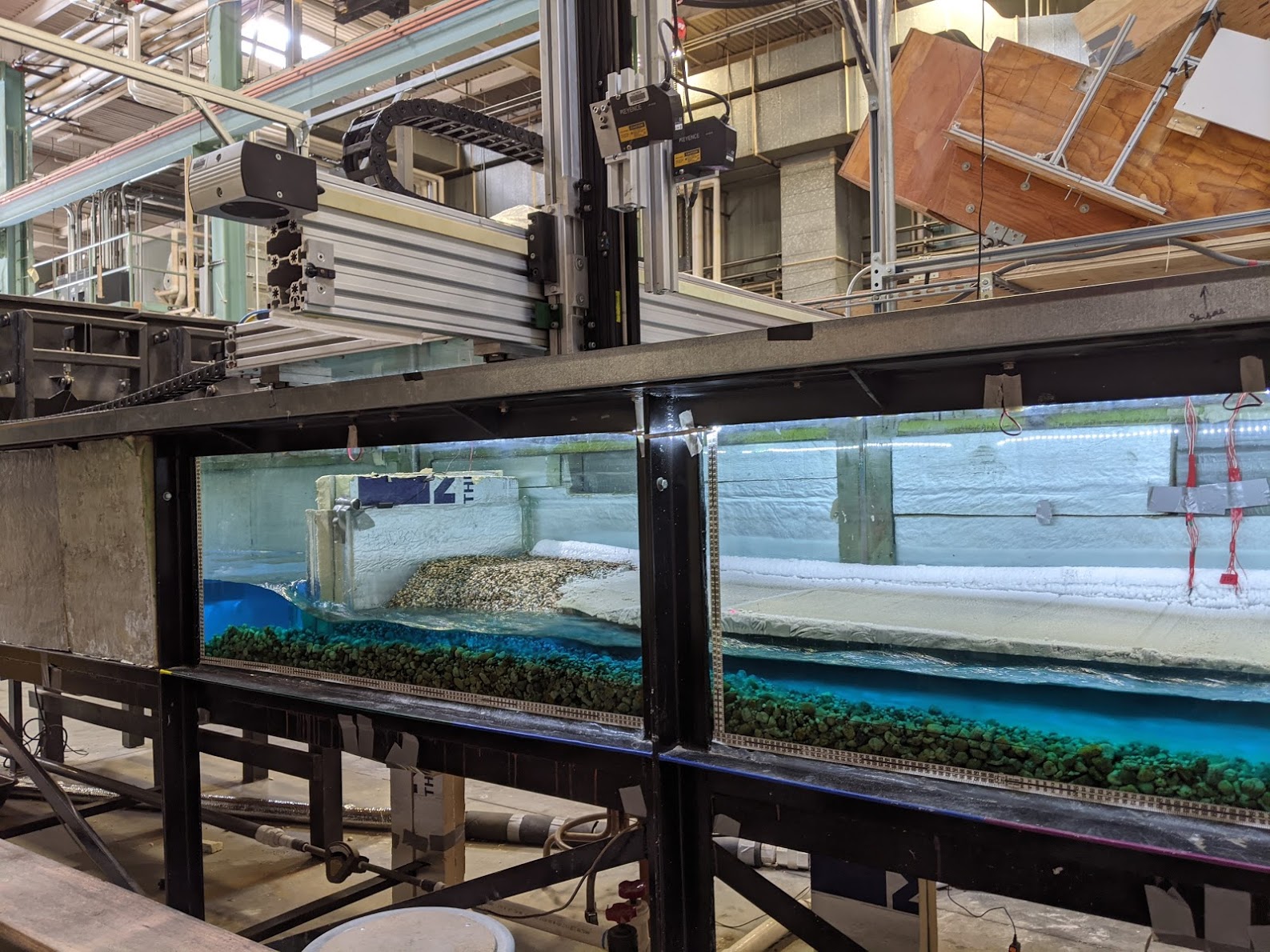
Lab Experiments
Running physical experiments allows us to test our understanding of how landscapes evolve under controlled conditions. My lab
Theory Development
Observations and measurements of landscape evolution can be codified using mathematical theories. Developing and testing these models allows us to make predictions about how landscapes have changed throughout Earth history and may evolve in the future. During my thesis, I used my observations from fieldwork and experiments to determine a set of equations hypothesized to govern permafrost riverbank erosion. My lab group is currently developing theory for permafrost gullies and organic carbon transport in river networks.